Fords and Ferries in Ironbridge
Ironbridge
The Free Bridge of Jackfield
Jackfield
Coalport bridge and toll houses.
Coalport
Coalport & Jackfield Memorial Bridge
Coalport
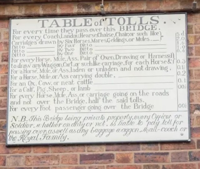
The Toll house
Ironbridge
Images in this collection
Click any photograph to open it full screen, zoom in and read the full caption.
Benthall Edge Ferry
About 1905
Here the Benthall Edge ferry hauls across on its wire rope, the ferryman's cottage tucked below the slope and the Edge rising steeply behind. Look closely and you can spot the taut rope cutting the water. Published around 1905 as a postcard titled 'Benthall Edge Ferry', it shows a crossing used daily by workers long before any road bridge existed here.
Published postcard, photographer unknown
Benthall Edge Ferry, colourised
About 1910
This hand-tinted postcard, made around 1910, shows the same Benthall Edge crossing from a gentler angle: a rowing boat drawn up in the foreground and stone steps cut into the bank on the Ironbridge side. Those steps, worn smooth by generations of boots, are easy to overlook but were the crossing's only real infrastructure for well over a century.
Colourised postcard
Waiting at the ferry landing
Early 1900s
A knot of passengers waits patiently at the stone landing steps of the Benthall Edge crossing in this real photographic postcard from the early 1900s. The ferry itself ran on a wire rope stretched bank to bank, with the ferryman hauling it hand over hand — a simple, tiring method that kept the crossing running for generations of local workers.
Real photographic postcard
The crossing beneath the Edge
About 1910
The steep, wooded flank of Benthall Edge towers over this tiny river crossing, photographed and tinted around 1910. Hidden among the trees on the far bank were limekilns and quarry tracks, industries the ferry quietly served alongside its passenger trade. It's a reminder that even the most scenic Gorge views often masked hard, ongoing industrial work.
Colourised postcard
Landing steps and rowing boat
Early 1900s
A single rowing boat sits moored beside the stone landing steps in this early 1900s photograph. Steps like these — narrow, uneven and treacherous when the river was in flood — were, remarkably, the only infrastructure most Gorge ferries ever received, a stark contrast to the grand bridges built elsewhere along this same stretch of river.
Archive photograph, photographer unknown
A mother and children at the ferry landing
Early 1900s
A mother and her children pause at the ferry landing in this early 1900s photograph, waiting for the boat that will carry them across. For hundreds of Gorge families the ferry wasn't a novelty but a daily necessity: a ha'penny each way bought passage to work at the tileworks, the foundry or the pit on the opposite bank.
Archive photograph, photographer unknown
The Meadow Ferry
Early 1900s
A crowded Meadow Ferry boat sits so still in this early 1900s photograph that its passengers are mirrored almost perfectly in the water below. Boats of this type routinely carried a dozen or more people at once, packed shoulder to shoulder for the short but essential crossing that shaved miles off the walk between riverbank communities.
Archive photograph, photographer unknown
Albert Edward Bridge
About 1910
This colourised postcard from around 1910 frames the Albert Edward railway bridge, opened in 1864, with an old-fashioned rowing boat drifting on the water beneath it. The juxtaposition wasn't accidental for the photographer: it captures, in a single image, the old world of the ferry crossing being quietly overtaken by iron, steam and the railway age.
Colourised postcard
A trow moored at Ironbridge
Late 19th century
A Severn trow — the broad, flat-bottomed sailing barge that carried the river trade — lies moored close to the Iron Bridge in this late Victorian photograph. Long before tourists came to admire the bridge itself, the Severn below it was a genuine working highway, carrying coal, iron and pottery to markets far beyond the Gorge.
Archive photograph, photographer unknown
The ford at Ironbridge
Undated
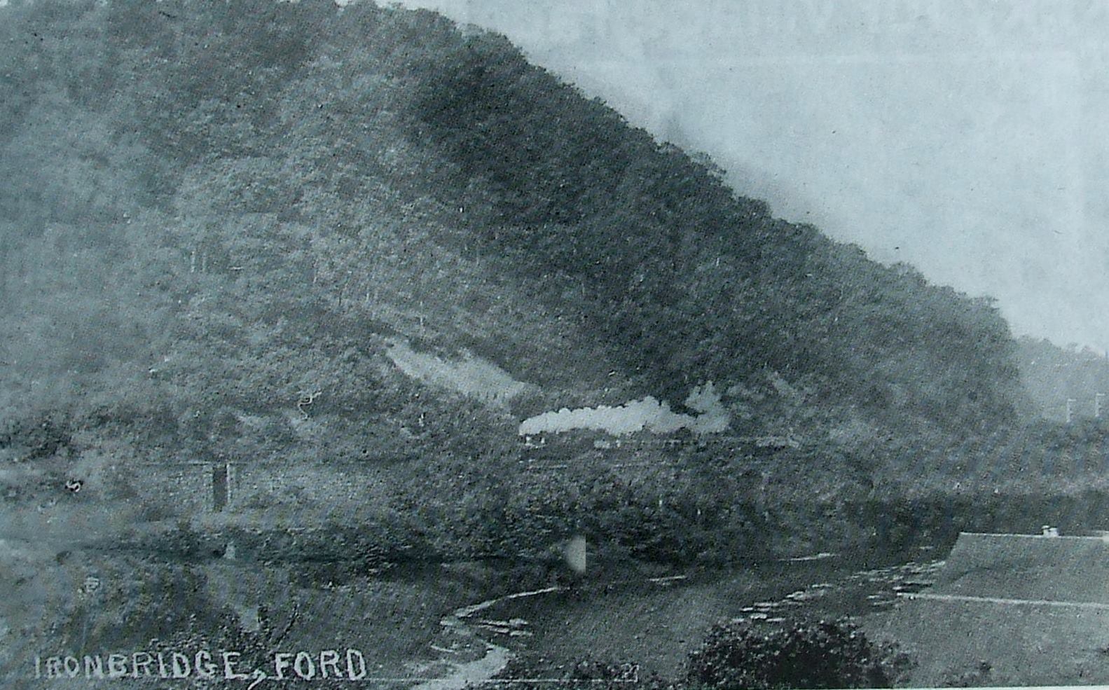
Captioned simply 'Ironbridge, Ford', this grainy, exact date unknown photograph records a crossing point used long before the ferries were formally established and well before the famous bridge was built. At low water, travellers and their goods simply waded or drove carts straight across the riverbed — the oldest and cheapest crossing method of all.
Archive photograph, photographer unknown
The ford, with the railway arches beyond
Early 1900s
The same ancient ford appears here in colour, photographed in the early 1900s, with the railway arches striding along the far bank behind it. The arches are a useful reminder that fords, ferries and railways all coexisted in the Gorge for decades, each serving a slightly different kind of traveller.
Colourised postcard
Crossing from Ironbridge to Jackfield
Before 1909
Photographed sometime before 1909, this scene shows the crossing from Ironbridge to Jackfield, with the gas works visible in the background — later a defining Jackfield landmark. This particular crossing would soon be made redundant by the construction of the Free Bridge, ending centuries of ferry use at this exact spot.
Archive photograph, photographer unknown
The last run of the ferries
1909
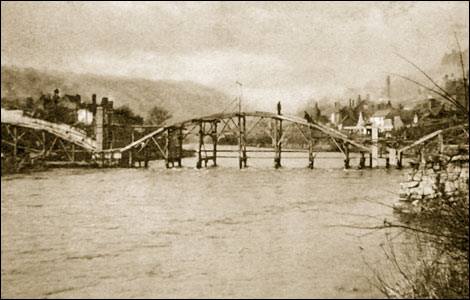
The newly completed bridge at Jackfield stands finished in this 1909 photograph, while the last of the old ferry boats is circled on the water below it, almost as an afterthought. It marks, quite precisely, the moment a centuries-old river trade came to an end, replaced overnight by fixed iron and stone.
Annotated archive photograph
The Passage Boat, Coalport
Early 1900s
Children pose in the foreground of this early 1900s postcard, formally titled 'The Passage Boat, Coalport'. 'Passage boat' was in fact the older, more formal term for what most Gorge residents simply called the ferry, a small linguistic clue to just how long this crossing had been in continuous use.
Published postcard
The 1799 Coalport ferry disaster
Modern graphic, historic photograph
A modern 'Did you know?' community history panel recalls the 1799 Coalport ferry disaster, illustrated here with a historic photograph of the ferry taken near the site of the later Memorial Footbridge. The pairing of old image and new text shows how local memory of a tragedy was kept alive across two centuries.
Community history graphic
Fords and ferries of the Severn Gorge
2010
Drawn up in 2010, this schematic map plots every recorded ford and ferry across the Severn Gorge against the line of the later road and rail bridges, stretching from Buildwas down to Apley Park. Seen together like this, the sheer number of crossings reveals just how central the river once was to daily local life.
Broseley Local History Society newsletter, February 2010