Themes
Names of the Gorge
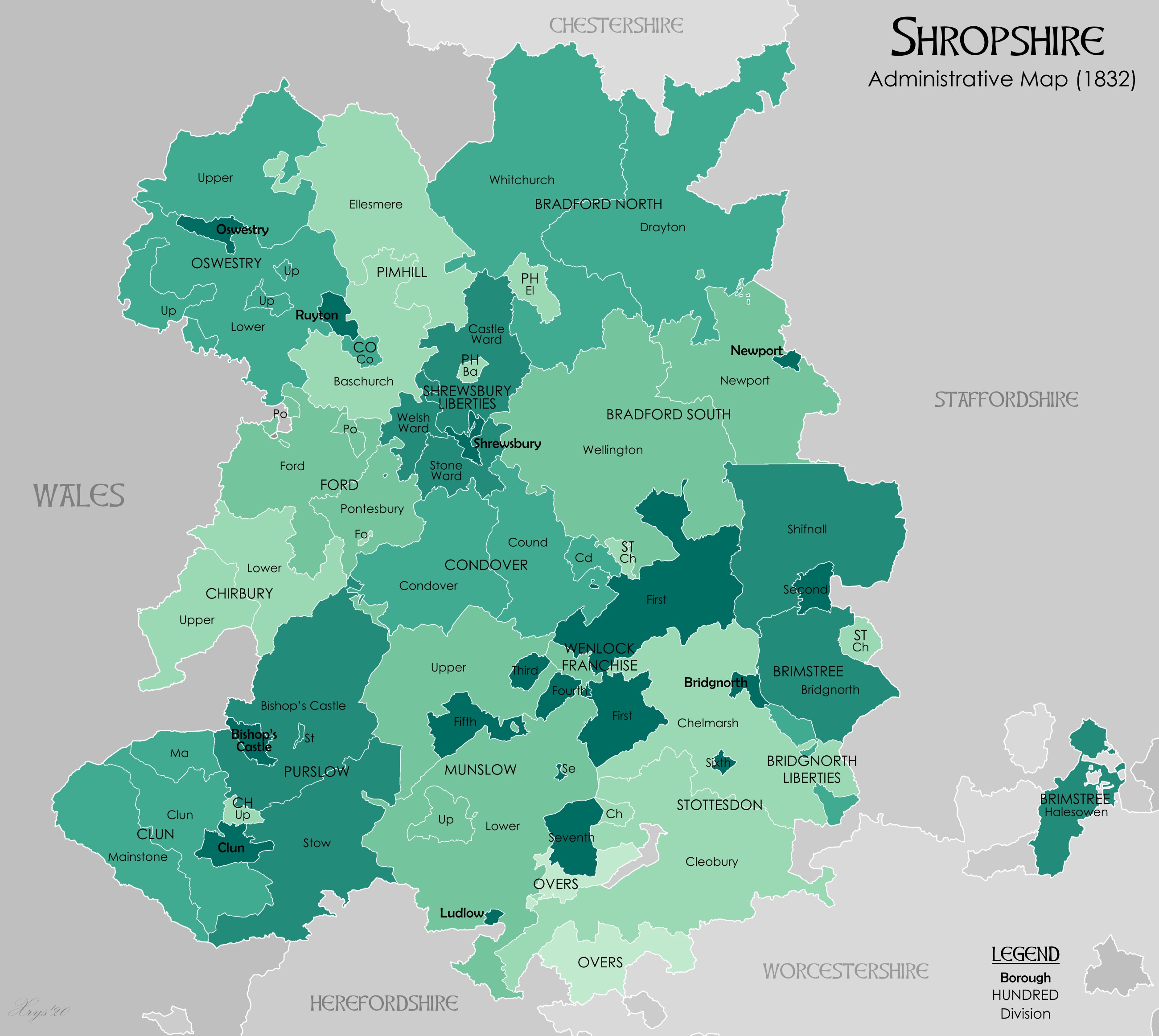
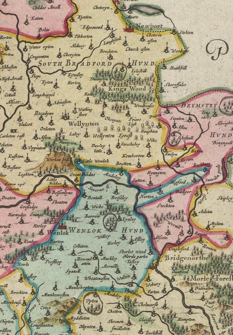
Before there was an Ironbridge, before Coalport's wharf or the clatter of Jackfield's tile works, the map of this part of Shropshire looked very different. In the Middle Ages it lay inside a huge administrative block called Bradford Hundred, later divided into North and South. The parishes of Madeley, Buildwas, Benthall, and Broseley all sat inside the southern division. A hundred was an Anglo-Saxon invention — an area that could raise a hundred fighting men or roughly a hundred households.
From those large medieval parishes grew the patchwork of names still known today: Coalbrookdale, Jackfield, Coalport, Benthall, Lloyds, Lincoln Hill, Jiggers Bank, Calcutts, Willey — each named for a craft, a landowner, or the lay of the ground.
The Maps that Froze Time
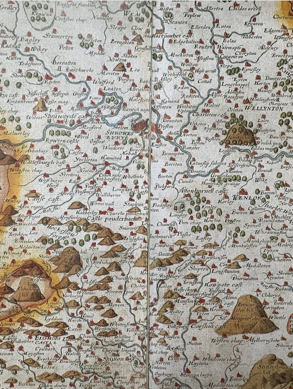
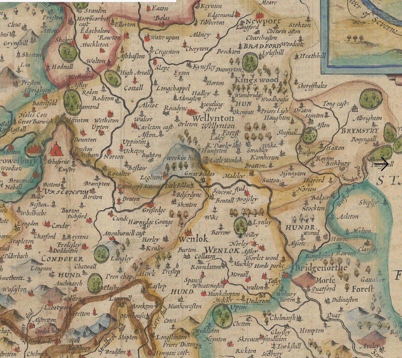
In 1574, Thomas Seckford commissioned Christopher Saxton to map every county — the first national atlas. By 1577 the maps were finished. Saxton's Shropshire is a world before industry — no Ironbridge, no canals, not even a road.
- John Speed (1610) reworked Saxton with a decorative cartouche and a town plan of Shrewsbury.
- Joan Blaeu (1665) hand-coloured the county for his Atlas Maior.
- Bassett & Chiswell (1676) reissued Speed's design.
- John Cary (1805) added canals, roads, and hachured hills.
- Greenwood (1830) surveyed the county yard by yard, engraving even the tramways and rope-walks.
- Ordnance Survey (1862) — the Gorge packed with pits, furnaces, cottages, limekilns, rope-walks, and pubs.
In three centuries the Severn valley went from an anonymous green sweep to the most documented industrial landscape in England.
Madeley — the Mother Parish
First record: Domesday Book (1086) as Maddelege — "Madda's lēah" (a clearing in the woods). Madeley parish stretched from the uplands above Coalbrookdale right down to the river, taking in Madeley Wood, Jackfield, and Coalport. By 1660 the once-common "Madeley woods" were fenced, mined, and worked.
By the 1849 Tithe Award, streets we still know — Court Street, Park Lane, Rope Walk, Wharfage, Victoria Road (once Shooting Butts Lane) — appear as property entries.
Coalbrookdale — The Cold Brook
Earliest known form: Caldebroc (1250), from Old English cald brōc — "cold brook." The "coal" spelling was a happy coincidence: the word changed naturally over centuries of speech, long before coal became the valley's fortune. "Dale" was a late 18th-century addition. By 1805, Cary's atlas prints "Coalbrookdale" for the first time nationally — by then the name had caught up with the fame of Abraham Darby's furnaces, where iron was first smelted with coke in 1709.
Dale End — The Edge of the Valley
A latecomer name for where Coalbrookdale's valley flattens and meets the Severn. Not on Saxton (1577), Speed (1610) or Blaeu (1665). First clearly printed by the Ordnance Survey (1862). During the 19th century it became a hive of iron foundries, warehouses, and workers' cottages.
Benthall — The Bent-Grass Nook
Earliest spelling: Benetala (12th century). From Old English beonet (bent grass) + halh (nook of land). Always in Broseley parish, not Madeley. Benthall Hall was begun 1535–1580, rebuilt after the Civil War. Already named "Bental" on Saxton's 1577 map. Beneath the cliff lay Bowyer's Yard — a row of cottages and workshops for quarrymen and ferrymen.
Broseley — The Guardian's Clearing
First recorded in Domesday (1086) as Broselie, from Old English Burgweard's lēah — "the clearing of the town guardian." Parish included Benthall, Lloyds, Calcutts, and Willey. By the 18th century, collieries and brickworks covered its slopes.
Jackfield — From Pasture to Port
First appears c.1550 as Jake Fylde — "Jack's field," from an earlier landholder. Originally open riverside pasture within Madeley parish. By the 18th century, "Jackfield" described the whole industrial settlement along the south bank. By Cary (1805) clearly marked; by OS (1862) lined with works, cottages, and wharves.
Notable inns: Boat Inn, Black Swan, Dog & Duck, Tumbling Sailor. The Tuckies Ferry, run from the Boat Inn, was the main crossing to Coalport until the Jackfield Memorial Footbridge opened in 1922.
Coalport and Preen's Eddy — From Eddy to Port
Before Coalport, this bend in the Severn was known as Preen's Eddy — a small ferry and farmstead. In 1780, William Reynolds extended the Shropshire Canal down from Blists Hill to meet the river here, building a wharf, warehouses, and inclined plane. The settlement became "Coalport" — literally the port for coal.
Closing Thoughts — A Valley of Names
From Madda's clearing to Jack's field, from Benthall's bent-grass nook to Coalbrookdale's cold brook, most names in the Gorge began with the land — not the industry. The English once named places for what they saw. The Victorians named them for what they built. The Ironbridge Gorge, layered with both, is where those two languages still meet.
More Gorge history
Read another story
Stay in the loop
More stories from the Gorge, straight to your inbox
A short weekly email with new history features, archive photographs and what's on across the Gorge.