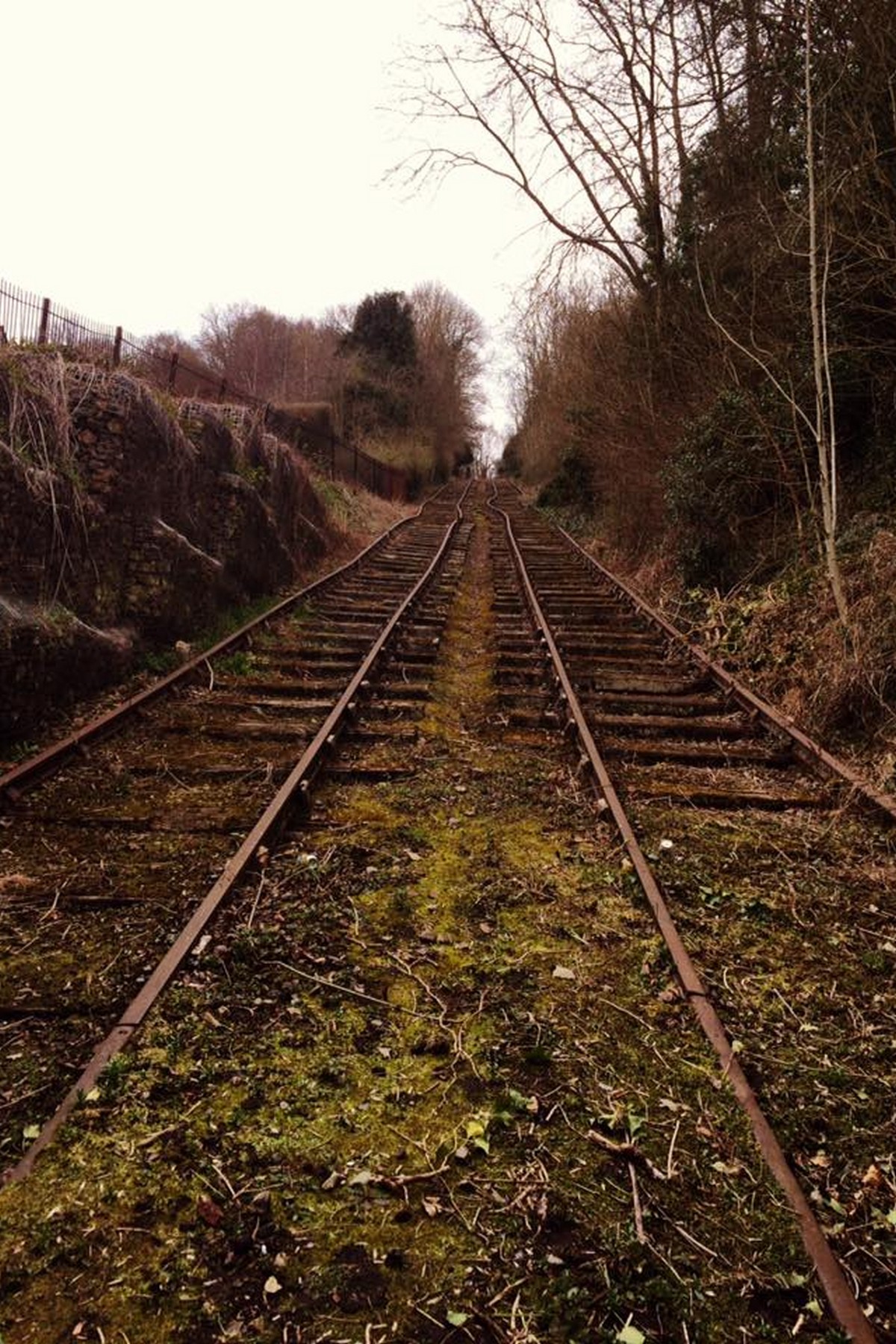
The tracks climb the wooded hillside, sunlight breaking through the canopy in this present-day photograph. It's a quiet walk now, popular with visitors, and arguably one of the best short climbs in the whole Gorge — though little in this peaceful scene hints at the noise and labour once heard here.
Local history

A digital exhibition · Coalport, Ironbridge Gorge

The Hay Inclined Plane

Coalport, Ironbridge Gorge

How Coalport lifted whole canal boats 207 feet up a hillside — an engineering marvel open to traffic by 1793, abandoned in 1894, rescued from the undergrowth, and still surviving on the hillside today.

Scroll to explore ↓

The Hay Inclined Plane — also known as the Coalport Inclined Plane — is the most extraordinary piece of engineering in the Ironbridge Gorge that most visitors walk straight past. Instead of a flight of locks, entire loaded canal boats were floated onto wheeled cradles and hauled up and down a railway on the valley side.

It joined the Shropshire Canal on the plateau at Blists Hill to the Coalport Canal beside the River Severn. What would have taken more than three hours by a conventional lock system took around four minutes here — and it worked for a century before the railways made it redundant.

Opened
1793
Built by
William Reynolds
Vertical drop
207 feet (63 m)
Length
c. 350 yards (320 m)
Gradient
About 1 in 4
Journey time
Around 4 minutes
Boats
Shropshire tub boats, 5 tons
Last recorded use
1894
Protection
Scheduled Monument & Grade II listed

Chapter one

The problem: 207 feet of hillside

The Shropshire Canal ran across the plateau at Blists Hill. The River Severn ran along the bottom of the Gorge. Between them was a wooded slope no canal could climb.

This hand-coloured plan of the Coalport area maps the canal and the plunging line of the incline down to the river — look closely and you can trace the china works, the Tar Tunnel and the wharves squeezed into the same tight stretch of valley. Surveyed in the late Victorian years, it shows just how crowded and industrious this small riverside settlement once was.Late VictorianThe map shows how tightly the incline, the china works, the tar tunnel and the river wharves were packed into the valley side.

By the late 1780s the industries of east Shropshire were producing more coal, iron, clay and china than the roads could carry. The obvious answer was a canal down to the Severn, where trows could take goods to Bristol and beyond.

The obstacle was the drop. Engineers proposed a long flight of locks, and others a water-balance lift, but both were slow, expensive and thirsty — this hillside had no spare water to pour away a lockful at a time.

Chapter two

Reynolds' solution

William Reynolds developed the idea for this extraordinary site from the inclined-plane technology already being pioneered on Shropshire's canal network.

A contemporary table listing Shropshire's inclined planes, giving the length and rise or fall of each — dry figures at first glance, but they reveal the Hay as the champion of them all, dropping over 200 feet in a single run. Compiled from records dating to 1793 and after, it captures the ambition of the canal age at its height.Late GeorgianThe Hay was the greatest of them — a drop of over 200 feet in a single run.

Inclined planes were already being developed elsewhere on the Shropshire Canal system, and Henry Williams and James Loudon are associated with the design adopted by the canal proprietors. The resulting Hay Inclined Plane became the largest and most spectacular of the local examples, with a fall of 207 feet (63 m) in a single run.

Built during the early 1790s and open to traffic by 1793, it used twin iron rails, wheeled cradles, a winding drum and steam assistance in place of what would otherwise have been twenty-seven locks.

Chapter three

How the incline worked

Six stages, four men, four minutes — and a whole loaded boat moved from the plateau to the riverside.

This diagram unpicks the incline's clever mechanics: tub boats floated onto wheeled cradles at the top, were hauled over the crest, and lowered on twin rails to the canal below. The trick, easy to miss, is that the rails ran on into the water at the bottom, letting a cradle sink beneath a boat to float it off — a piece of ingenuity typical of the site's Georgian origins.Interpretation diagramAt the lower basin the rails ran on into the water so a cradle could sink beneath a boat and float it off.
  1. Step 01

    Into the basin

    A loaded Shropshire tub boat — 20 feet long, carrying about five tons — was poled into the stone-lined basin at the top of the incline.

  2. Step 02

    Onto the cradle

    The twin rails continued down into the water. A wheeled cradle was lowered beneath the boat so the hull settled onto it as the water drained away.

  3. Step 03

    Over the crest

    A steam-driven winding drum in the engine house drew the cradle over the summit and onto the slope. From there gravity took charge.

  4. Step 04

    Counterbalance

    A descending loaded boat hauled an empty one up the parallel track. The engine only had to make up the difference, not lift the whole weight.

  5. Step 05

    Braking the descent

    Brakemen controlled the drum as the cradle ran down a gradient of about one in four — a drop of 207 feet in a few hundred yards.

  6. Step 06

    Afloat again

    At the bottom the rails ran into the Coalport Canal. The cradle sank, the boat floated off, and it carried on to the Severn wharves.

Locks compared with the Hay Inclined Plane
MeasureA flight of locksThe Hay Inclined Plane
Height change27 locks of roughly 7ft eachOne run of 207ft
Time for the journeyMore than three hours by a conventional lock systemAbout 4 minutes
Water usedA lockful drained per boatAlmost none
Crew neededBoat crews plus lock keepersFour men ran the whole plane
CapacityA handful of boats a dayHistorically worked at up to six boats an hour

The genius of the Inclined Plane is that it took just four minutes to move tons of goods from the world's most advanced ironworks high up in Blists Hill down to the River Severn.

Paul Green, volunteer guide

Chapter four

The machinery and the men

An engine house at the summit, a winding drum, brakemen on the slope and a basin at each end — the Hay was a machine the size of a hillside.

This museum model at Blists Hill recreates the Hay Inclined Plane in miniature, with its engine house, winding drum and paired cradles clearly laid out on the twin tracks. Notice how the two cradles balance each other, one rising as one falls — the very principle that let the incline move heavy cargo without wasting steam. It is the clearest way to picture machinery long vanished from the actual hillside.Present dayThe model is the easiest way to picture the machinery that has long since gone from the hillside.
These ivy-clad buildings beside the incline at Coalport once served the works clustered at the foot of the slope, in the early years of the twentieth century. The winding house proper stood higher up, at the summit near SJ 695028, and its ruined walls and tall brick chimney were still standing as late as 1974 — a slow, visible decay rather than a sudden loss.Early 1900sThe winding house itself stood at the summit, at SJ 695028; its ruins and tall brick chimney still stood in 1974.
Looking up from the Coalport valley floor towards the incline, with works and cottages crowded in the foreground, this early-1900s view captures the everyday traffic of the place: coal, iron, clay and finished Coalport china all travelled this route between Blists Hill and the Severn wharves. It's easy to forget, standing here today, how industrial this quiet corner once felt.Early 1900sCoal, iron, clay and finished china all passed this way between Blists Hill and the Severn wharves.
A sweeping panorama down the incline towards the brick bridge, the canal basin and the wharves beyond — the arch below carries Coalport High Street over the Coalport Canal at the foot of the Hay Inclined Plane. Exact date unknown, but the print's tone and composition place it firmly in the working decades of the incline's life.Early 1900sThe arch below is the Coalport High Street bridge over the Coalport Canal at the foot of the Hay Inclined Plane.
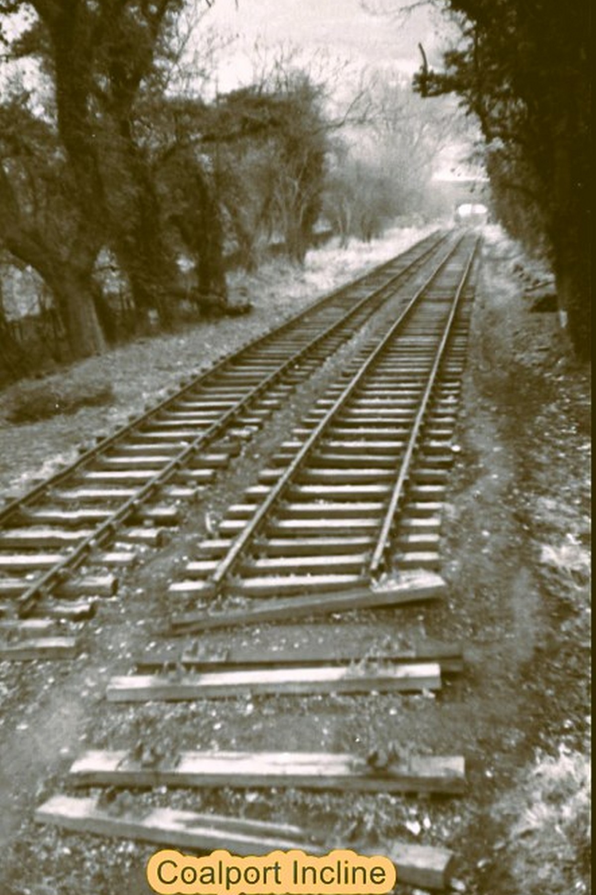
Simply captioned “Coalport Incline”, this archive print shows twin tracks running away into the trees, the two rails a deliberate piece of design: a loaded boat descending counterbalanced an empty one climbing, sparing the winding engine much of its work. The photograph itself carries no date, so it is best placed generally within the incline's operating years.Late 1800sTwo sets of rails allowed a loaded boat descending to counterbalance an empty one climbing.

Chapter five

Silence: the Inclined Plane abandoned

The railways did what no hillside could. The last recorded use of the Hay Inclined Plane was in 1894, and the valley began to swallow it.

This archive print of the overgrown incline carries its own printed note dating it to before 1905, and records that the Hay was last used in 1894 — a detail that lets us fix the image to somewhere around the turn of the century. Vegetation is already reclaiming the track bed, the first sign of the long decline that followed closure.Around 1900The printed caption records that the Hay was last used in 1894, which suggests a date around the turn of the century.

For a century the incline had been the lifeline of Coalport's china works, the tile factories at Jackfield and the ironworks above. But rail could take goods straight from works to port without transhipment, and the tub-boat canals could not compete.

After closure the engine was removed, the rails were lifted or buried, and scrub took the slope. By the 1950s a walker could pass along the valley road and never guess what lay above.
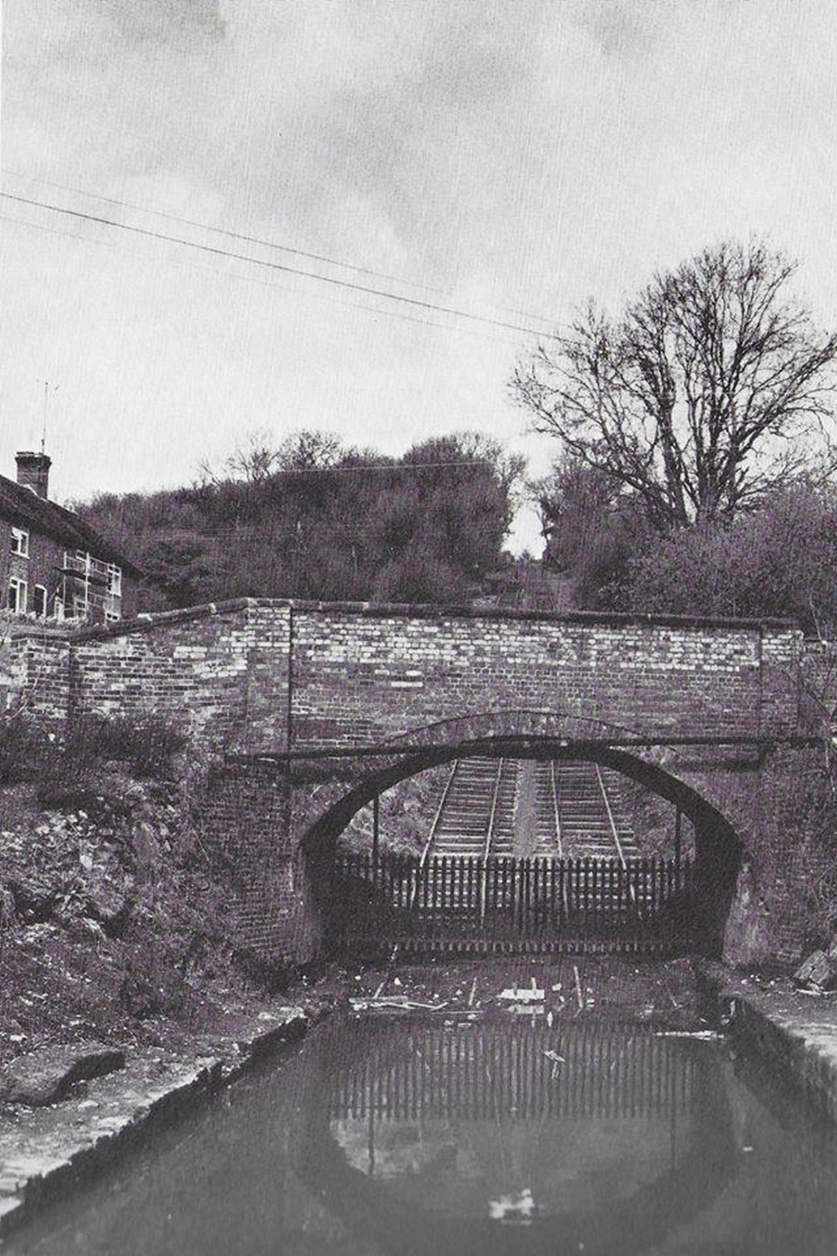
The brick bridge at the foot of the incline, with cottages beyond, photographed around the mid-twentieth century when this modest arch was almost all a passer-by would have noticed of the great machine rising above it. The incline itself lay hidden under decades of undergrowth, its history all but forgotten by casual visitors.Mid 20th centuryFor years this was almost all that a passer-by would have noticed of the great machine above.
A surviving sleeper and its heavy bolts, photographed as the buried line was uncovered during restoration work. Original ironwork like this — much of it still sound after decades underground — guided the volunteers relaying the track and confirmed exactly where the rails had once run, making it a small but crucial clue in the restoration effort.Inter-war yearsOriginal ironwork like this guided the volunteers relaying the track.
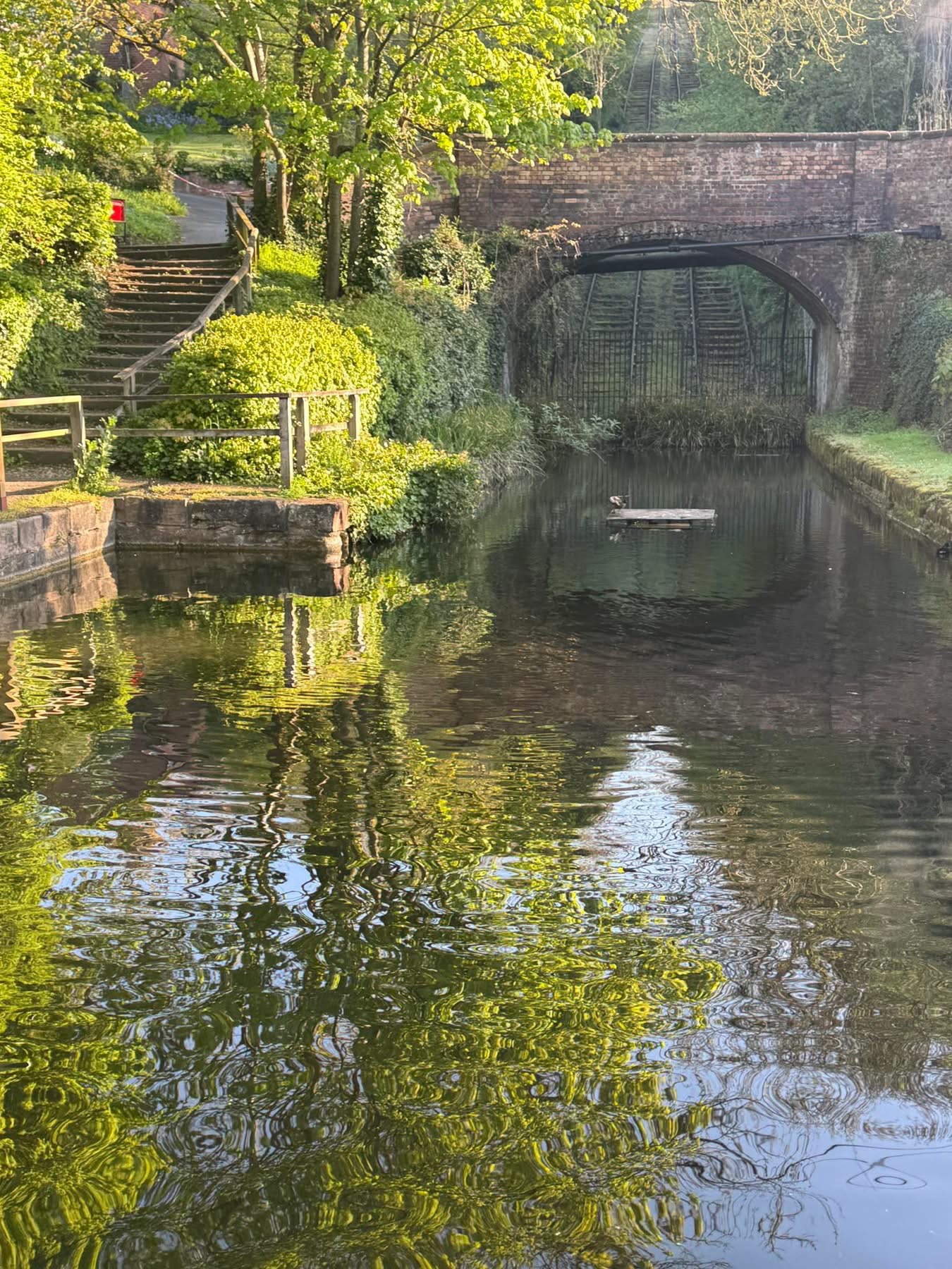
The canal basin at the head of the incline today, looking towards the Coalport High Street bridge, with the twin tracks climbing away beyond it. The basin holds water again, with steps and handrails now leading down to the top of the incline — a small, deliberate touch that lets present-day visitors stand exactly where the tub boats once floated.
The brick bridge over the incline, seen across the still water of the basin in this photograph from the preservation era — one of the site's classic viewpoints, framed the same way then as it often is now. The reflection in the water hints at how much care went into refilling this basin after decades dry.
ThenNow
Then & now: the basin and the brick bridge at the head of the incline. Drag the handle to compare the derelict years with the restored, water-filled basin today.

Chapter six

Rescued from the undergrowth

Restoration began in 1968, with further restoration in 1975, including reinstatement of the rails. Museum staff, volunteers and Venture Scouts were all part of the effort to cut back the scrub, dig out the channel and bring the line back into view.

Clearance work on the overgrown incline, undertaken through the 1960s and 70s, shows just how much had to happen before any rail could even be found: scrub was cut back entirely by hand, slope by slope, revealing the stone-walled channel beneath decades of neglect. This unglamorous labour was the true first step of the incline's revival.1960s-70sScrub was cut back by hand before the buried rails could even be found.

The site is now protected as a Scheduled Monument and is Grade II listed. More recently the Ironbridge Gorge Museum Trust completed major conservation work funded through Arts Council England's MEND programme — clearing self-seeded trees from the canal basin, repairing the Winding House, replacing failing concrete capping with turf, and installing new visitor steps and handrails. The Trust announced the completion of that work and the reopening of the Hay Inclined Plane in April 2025. The historic machinery has not been returned to working order; what has been conserved is the structure itself.

Chapter seven

A monument on a hillside

A Scheduled Monument and Grade II listed structure within the Ironbridge Gorge UNESCO World Heritage Site — protected as one of the most important surviving inclined planes in the world.
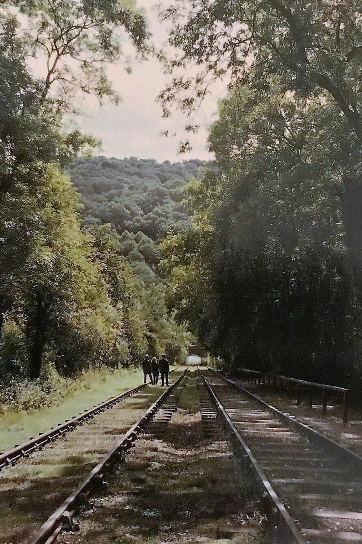
Captioned “Hay Hill Incline 1977”, this photograph shows the cleared slope running between its stone retaining walls, restoration by this date well advanced. The Inclined Plane's importance was later formally recognised: it is protected as a Scheduled Monument and is Grade II listed, a rare survival of Georgian tub-boat technology.1977The Inclined Plane is protected as a Scheduled Monument and is Grade II listed.
The relaid twin tracks run straight through the trees in this present-day photograph. Look closely and you'll notice these rails are a careful reconstruction, laid on the original alignment surveyed decades earlier — a faithful echo of the working line rather than a museum invention.
Simply captioned “Coalport Incline”, this archive print shows twin tracks running away into the trees, the two rails a deliberate piece of design: a loaded boat descending counterbalanced an empty one climbing, sparing the winding engine much of its work. The photograph itself carries no date, so it is best placed generally within the incline's operating years.
ThenNow
Then & now: the twin tracks running away into the trees, a century apart.

Chapter eight

The Inclined Plane today

The rails climb through the trees, the basin holds water at the top, and the brick bridge still frames the view from below — still surviving on the hillside today, and one of the most remarkable industrial survivals in the Gorge.

Today's view down the grassed slope, framed by stone ruins, towards the valley bridge below. The scale of the drop is only obvious once you stand at the top and look down — a useful reminder that this gentle-looking walk was once a working industrial gradient carrying loaded boats.Present dayThe scale of the drop is only obvious when you stand at the top.
The relaid twin tracks run straight through the trees in this present-day photograph. Look closely and you'll notice these rails are a careful reconstruction, laid on the original alignment surveyed decades earlier — a faithful echo of the working line rather than a museum invention.Present dayThe rails you walk beside are a reconstruction on the original alignment.
The tracks climb the wooded hillside, sunlight breaking through the canopy in this present-day photograph. It's a quiet walk now, popular with visitors, and arguably one of the best short climbs in the whole Gorge — though little in this peaceful scene hints at the noise and labour once heard here.Present dayA quiet walk now, and one of the best short climbs in the Gorge.
The full sweep of the incline today, flanked by trees with a brick house to one side, gives a real sense of scale: roughly 350 yards of track climbing at a gradient of about one in four. Few visitors expect the slope to feel quite this steep until they walk it themselves.Present dayRoughly 350 yards of track on a gradient of about one in four.
Rails run uphill past a brick cottage and stone gabion walls in this present-day view — a detail worth noticing is just how close the houses sit to the track. People still live within a few feet of one of Britain's great industrial monuments, a reminder that this was always a working, lived-in landscape rather than a museum piece.Present dayPeople still live within a few feet of one of Britain's great industrial monuments.
The drained, stone-lined basin chamber at the head of the incline sits dry and grassed over today. When it held water, this is where a tub boat floated onto its cradle, the rails running down into the basin itself, before the long descent to the canal below — a detail that explains the odd sunken rails still visible at the chamber's edge.Present dayWhen it held water this is where a tub boat floated onto its cradle, with the rails running down into the basin, before the descent.
The Hay Incline bridge, west of Coalport, carries the incline over the former L&NWR railway line — not to be confused with the Coalport High Street bridge over the canal at the foot of the slope, a mix-up easy to make on a first visit. The Silkin Way and Severn Valley paths meet close by, making this a natural crossing point for walkers today.Present dayNot to be confused with the Coalport High Street bridge over the canal at the foot of the slope. The Silkin Way and Severn Valley paths meet close by.
The canal basin at the head of the incline today, looking towards the Coalport High Street bridge, with the twin tracks climbing away beyond it. The basin holds water again, with steps and handrails now leading down to the top of the incline — a small, deliberate touch that lets present-day visitors stand exactly where the tub boats once floated.Present dayThe basin holds water again, with steps and handrails down to the top of the incline.

Plan your visit

Visiting the Hay Inclined Plane today

The Hay Inclined Plane can still be explored as part of the historic landscape between Coalport and Blists Hill. Public paths around Coalport give views of the lower canal, bridge and incline, while the upper section forms part of the Blists Hill Victorian Town site.

The route is steep — roughly one in four — with steps and handrails in places, so sensible footwear helps and it is not suitable for wheelchairs or buggies. Access arrangements vary between the public paths and the museum site, so check before you set out.

Coalport China Museum is a useful starting point for exploring the Coalport end of the site; check current museum opening times and facilities before visiting. The Woodbridge Inn and the Jackfield Memorial Footbridge are a short riverside walk away.

  • Coalport China Museum

    At the foot of the incline — check current opening times and facilities.

  • The Tar Tunnel

    Natural bitumen springs beneath the hillside — currently closed to visitors.

  • Blists Hill Victorian Town

    At the top of the incline, with the Shropshire Canal and Madeley Wood furnaces.

  • Coalport Bridge

    John Onions' cast iron arch of 1818, a short walk upstream.

  • Shakey Bridge

    The Coalport & Jackfield Memorial Footbridge across the Severn.

  • The Silkin Way

    The old railway route north, following the line of the canal.

Have photographs of the Hay Inclined Plane? Pictures of the clearance work, the relaying of the track or the incline before restoration would help grow this exhibition — send them to us on Facebook and we'll add them with a credit.

Sources & further reading

  • Historic EnglandThe Hay (Coalport) Inclined Plane — Scheduled Monument and Grade II listing entries.
  • Ironbridge Gorge Museum TrustConservation of the Hay Inclined Plane, including the Arts Council England MEND programme and the April 2025 reopening.
  • Canal & River TrustArchive and collections material on the Shropshire and Coalport canals and their inclined planes.

Keep exploring

Continue exploring the Gorge